Mine stability monitoring

Lihir gold mine in Papa New Guinea (Credit: Newcrest)

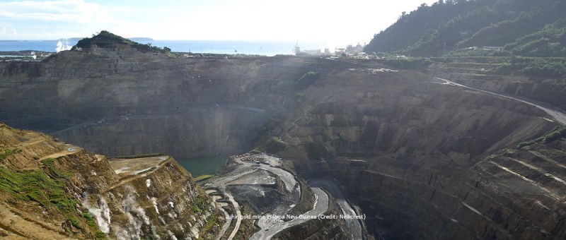
Mine stability monitoring with satellite InSAR One of the main challenges in the mining sector is the monitoring of ground behaviour over large assets, which often experience displacement due to operational activities. Slope instability in particular can be a significant threat to the integrity of mine sites and staff safety. Regular and accurate site stability…

TRE Altamira and GEORESEARCH: The SedInOut project

The SedInOut project

The collaboration with GEORESEARCH started more than one year ago with the launch of the InSAR Competence Center in Salzburg. The project is aimed at developing innovative InSAR applications based on cutting-edge technologies for monitoring alpine areas, which are particularly challenging for data analysis and interpretation. In 2019, inspired by the success of this cooperation,…

Ground motion monitoring of Italian regions

Ground motion monitoring of Italian regions to prevent and mitigate natural disasters and support urban development Since 2014, and the launch of the first ESA Copernicus’ Sentinel-1A radar, and later, Sentinel-1B, TRE Altamira has joined forces with the Civil Protection Centre of the University of Florence, in order to detect and monitor ground motion and…

Precursor of Maoxian Landslide Measured from Space

lanslide photo

SqueeSAR® measurements reveal clear, precursory movements of the ground months before the Maoxian landslide occurred. On 24 June 2017, a massive landslide hit a village in Maoxian county in Sichuan province, south-western China, destroying 40 homes and killing dozens of people (BBC news here). Authorities suggest the event was triggered by prevailing heavy rains. TRE…