

Investigate and monitor geohazards over wide areas, assess the temporal evolution of a single, at risk, location
Wide area monitoring
From historical analyses to near-real time monitoring programs at regional and national scales.
Timely displacement information over large areas is obtained by combining C- and L-band satellite imagery (ALOS-2, ALOS-4, SAOCOM, NISAR).
- Identify areas at risk: Landslide, natural or induced subsidence
- Update existing landslide inventories
- Elaborate a comprehensive risk management strategy based on up-to-date and measurable data
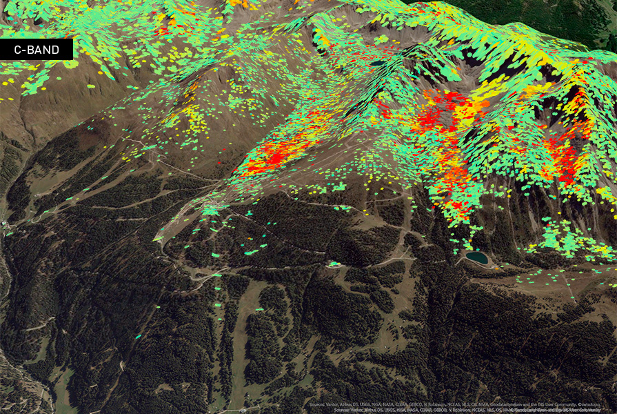
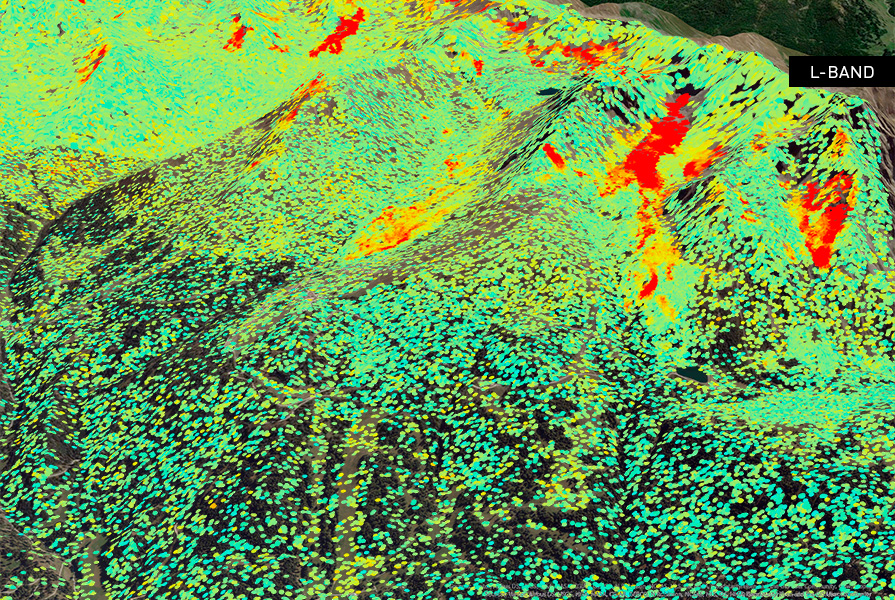
InSAR results from a wide-area Alps project using Sentinel-1 and SAOCOM data. A multi-frequency approach provides robust ground displacement information and a superior value proposition for hydropower reservoir monitoring. Source SAR imagery: Contains modified Copernicus Sentinel data 2022-2025.
This slideshow requires JavaScript.
Frequent monitoring
We offer different approaches to detect and monitor complex motion related to the area at risk.
With our multi-temporal satellite studies, we can follow the evolution of the instability area, ranging from millimeters/year to meters:
- Assess the evolution of geological criticality and the residual risk after the event
- Frequent monitoring and a machine learning algorithm to highlight Trend Variation
- Support the installation of in-situ instruments
Interested in what we can do for you?
-
Talk to our sales team
your project, our solutions