

A cross-border collaboration to improve hazard identification and mitigation efforts
In our September 2020 post ‘TRE Altamira and GEORESEARCH: The SedInOut Project‘, we highlighted our involvement in Interreg Europe, a interregional program funded by the European Regional Development Fund (ERDF). By encouraging knowledge and information sharing across regions, Interreg Europe helps local and regional governments across Europe develop better public policy practices and improve strategies for their citizens.
TRE Altamira enjoyed contributing its data for SedInOut and is proud to have been a part of two other projects involving InSAR monitoring over Italy and Switzerland: INTERREG V-A Italia Svizzera A.M.AL.PI.18 and INTERREG V-A Italia Svizzera SICt, which combined, cover an area of about 20,000 km2.

A.M.AL.PI.18 is focused on monitoring ground displacement over the Alps to better understand the geology and aid in detecting and mitigating natural hazards. The project also promotes access to natural and cultural resources of both regions, to help share scientific and geocultural knowledge and improve tourism activities.
On the other hand, SICt, focuses on monitoring critical transportation infrastructure across borders to encourage communication procedures between countries that help strengthen conjunctive risk management programs. Both projects count on the accuracy and reliability of the radar satellite remote sensing technology to assist in their objectives.
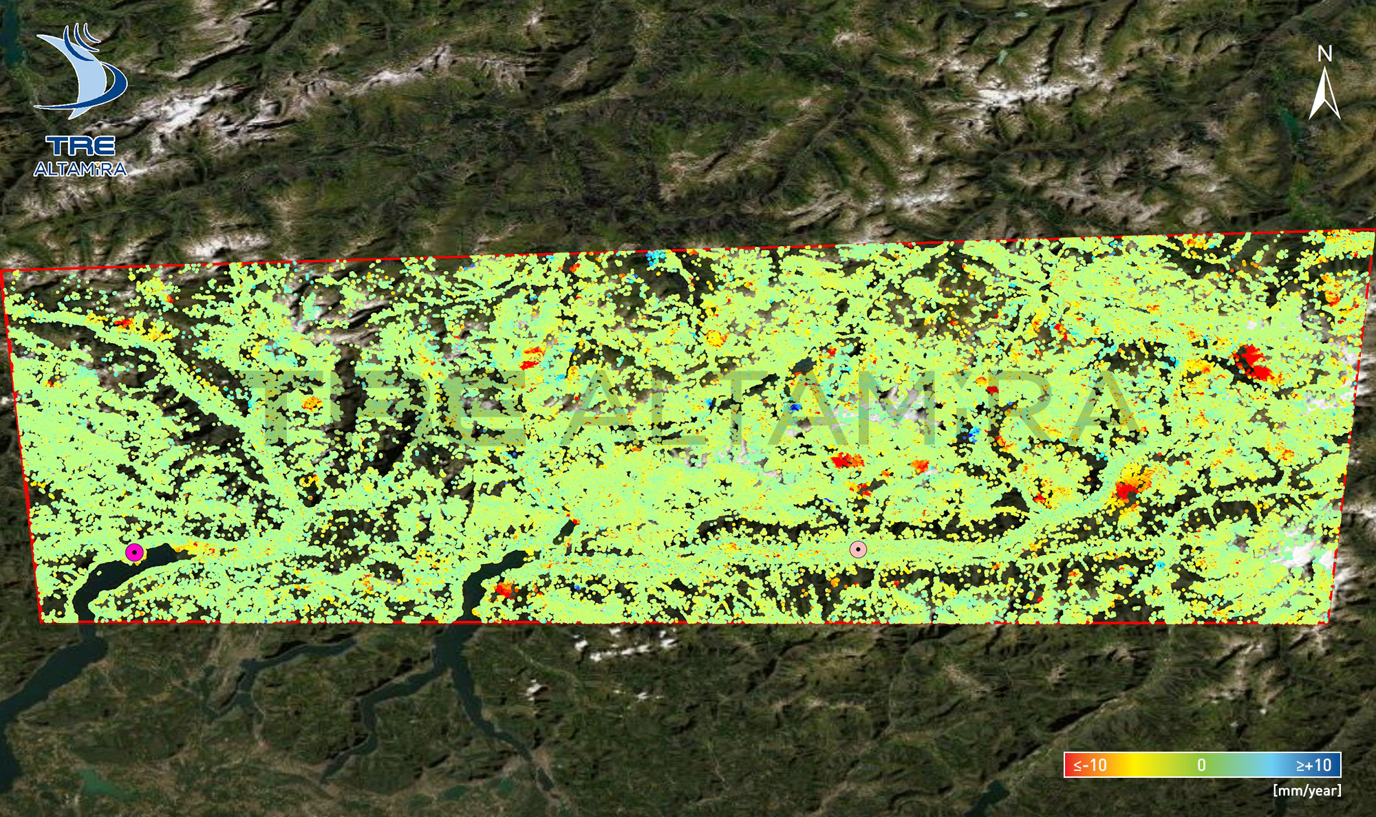
TRE Altamira contributed to the projects by using its advanced SqueeSAR® algorithm to process Sentinel-1 and Cosmo-SkyMed imagery and provide ground displacement measurements to monitor areas affected by natural hazards (landslides).
Over 2,300 Sentinel-1 images were processed (from March 2015 to November 2021) and updates were delivered on a 36-day frequency. Over areas of concern, where higher-resolution data was required, a bi-annual trend variation and change detection analysis using Cosmo-SkyMed data was also delivered.


Thanks to ALOS-2 imagery, we were able to provide historical ground displacement information over areas where Sentinel-1 and Cosmo-SkyMed satellites imagery was not acquired.
The successful combination of radar data from these three satellites provided a comprehensive analysis over the area of study. The results of the monitoring along critical transportation infrastructure were presented by our colleagues during the 2-day webinar organized by Regione Lombardia (click on Day 1 and Day 2 to watch the webinar).