
In this special year, when TRE ALTAMIRA (TREA) celebrates its 25th anniversary as a leading provider of InSAR services, our multi-year collaboration with Airbus has been extended with a new multi-year agreement for high-resolution radar imagery. This renewed commitment ensures TREA’s access to Airbus’s TerraSAR-X and PAZ satellites, further solidifying the companies’ joint efforts to deliver high-resolution radar imagery for critical surface movement analysis.
TREA utilizes this imagery, including historical archives and new acquisitions, to generate millimetric-accuracy ground displacement measurements for critical applications like infrastructure integrity, oil field monitoring, and environmental stability.
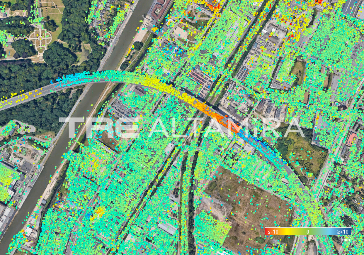
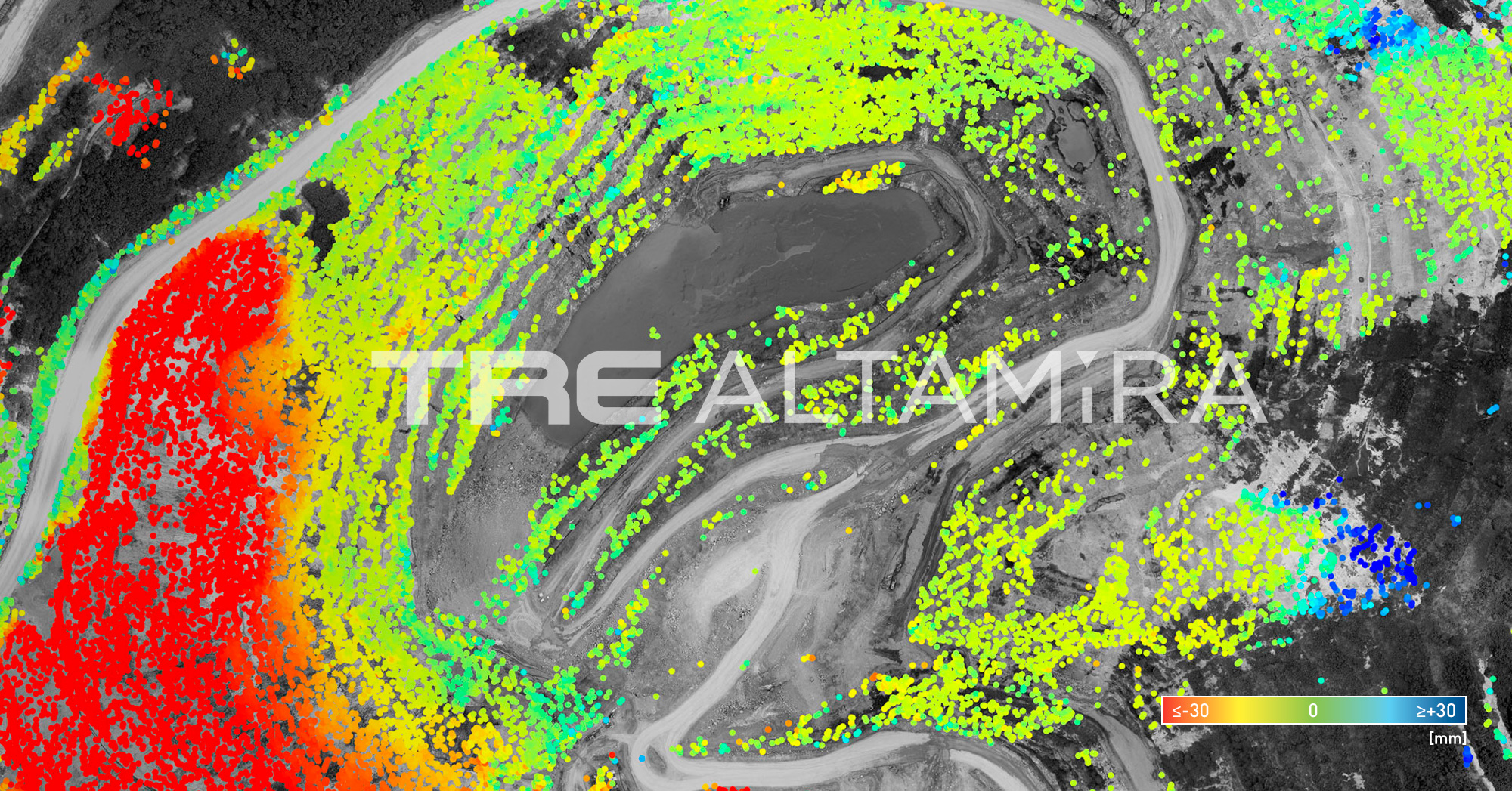
This agreement ensures that global customers will continue to have access to premium radar data and advanced analysis tools. These resources support improved monitoring and better-informed decisions, contributing to a more sustainable future.
Read more about it: https://space-solutions.airbus.com/resources/news/various/airbus-and-tre-altamira-sign-new-radar-imagery-framework-agreement/