Proactive TSF integrity| Early warning | Operational continuity

The catastrophic consequences of Tailings Storage Facility (TSF) failures—including severe environmental, social, and economic damage—underscore the critical need for continuous, accurate monitoring.

To ensure safety and productivity, operators require a dynamic, full-scale intelligence solution that translates complex environmental data into clear, actionable information.

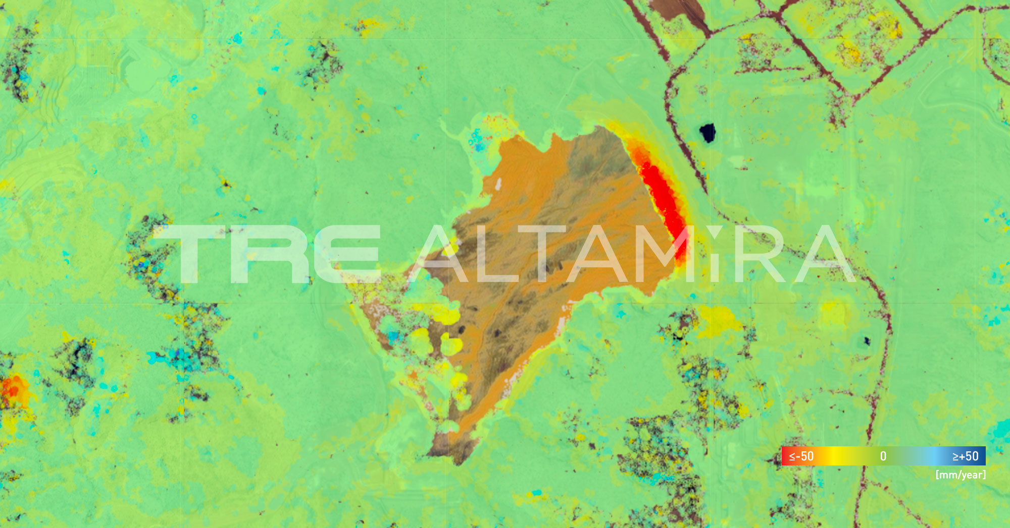
SqueeSAR® results over a tailings storage facility and its surroundings, showing ground displacement and water-body maps (light blue areas). © TRE ALTAMIRA 2026. Source SAR imagery: © DLR e.V. 2021-2022 and © Airbus Defense and Space GmbH

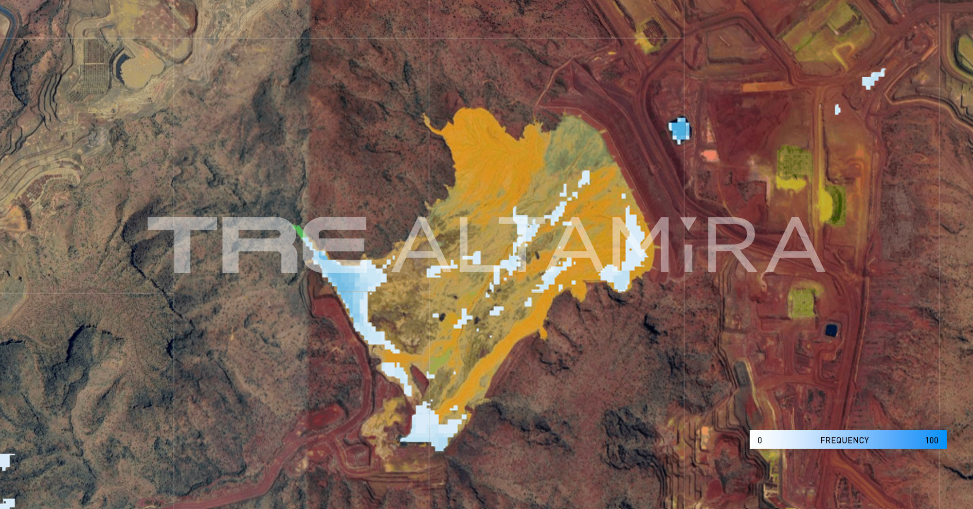
Water frequency maps. Light blue areas represent water frequency, with the shade indicating the percentage of images in which a pixel is water-covered. © TRE ALTAMIRA 2026. Source SAR imagery: © TRE ALTAMIRA 2026. Source SAR imagery: Contains modified Copernicus Sentinel data 2021

The challenge

Given the vast extent of the TSF, full spatial coverage is required. Without a synoptic view able to cover “blind spots”, it is difficult for TSF engineers to reliably assess the stability of the entire structure and effectively manage risks like water pond movement.

Our solution

Our solution monitors surface stability across the entire facility and surrounding areas—providing also an additional level of water and moisture frequent mapping. By facilitating a rapid and thorough data analysis, the TREmaps® platform serves as a primary intelligence hub, helping turn complex monitoring data into clear, actionable insights. It integrates multi-source data into a single, intuitive interface, allowing you to:

  • Early risk detection: Early identification of surface instabilities with millimeter-level sensitivity and accuracy
  • Track pond dynamics: proactively track water and moisture patterns inside the TSF ponds.
  • Preserve a long-term perspective: Maintain a track record of stability data across different construction stages.

The client benefits

Engineers achieve total accountability through full visibility, leveraging data-driven decisions to proactively mitigate risks and maintain uninterrupted operations across the entire TSF.

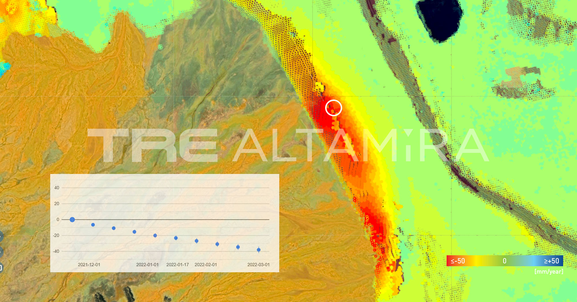
Zoom in on the tailings dam affected by ground displacement. The time series of a measurement point (MP) shows the movement over time. © TRE ALTAMIRA 2026. Source SAR imagery: © DLR e.V 2021-2022 and © Airbus Defense and Space GmbH

By bridging the gap between complex satellite analysis and real-world safety, our solution provides the full visibility required for total site accountability. Our TREmaps® platform serves as a vital link to converting monitoring data into actionable information, allowing operators to make data-driven decisions, proactively prevent failures, and secure the future of the facility.