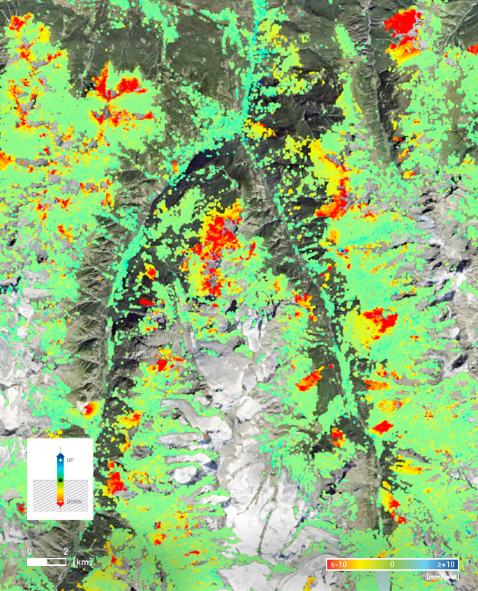
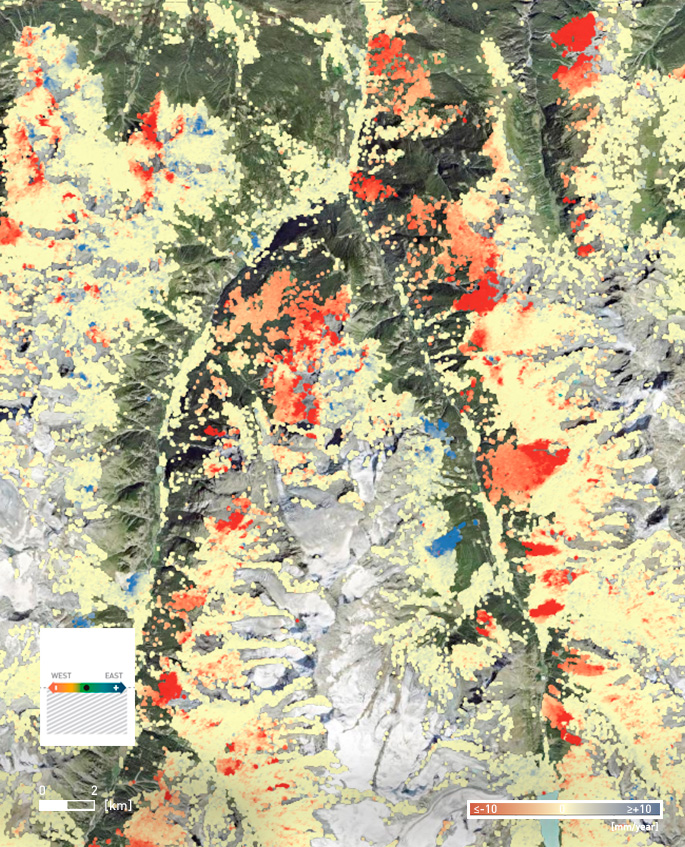
Landslide Detection| Natural Hazard Management | Wide Area Monitoring

Vertical 2-D SqueeSAR® results over Swiss Alps. Contains modified Copernicus Sentinel data 2014-2022.

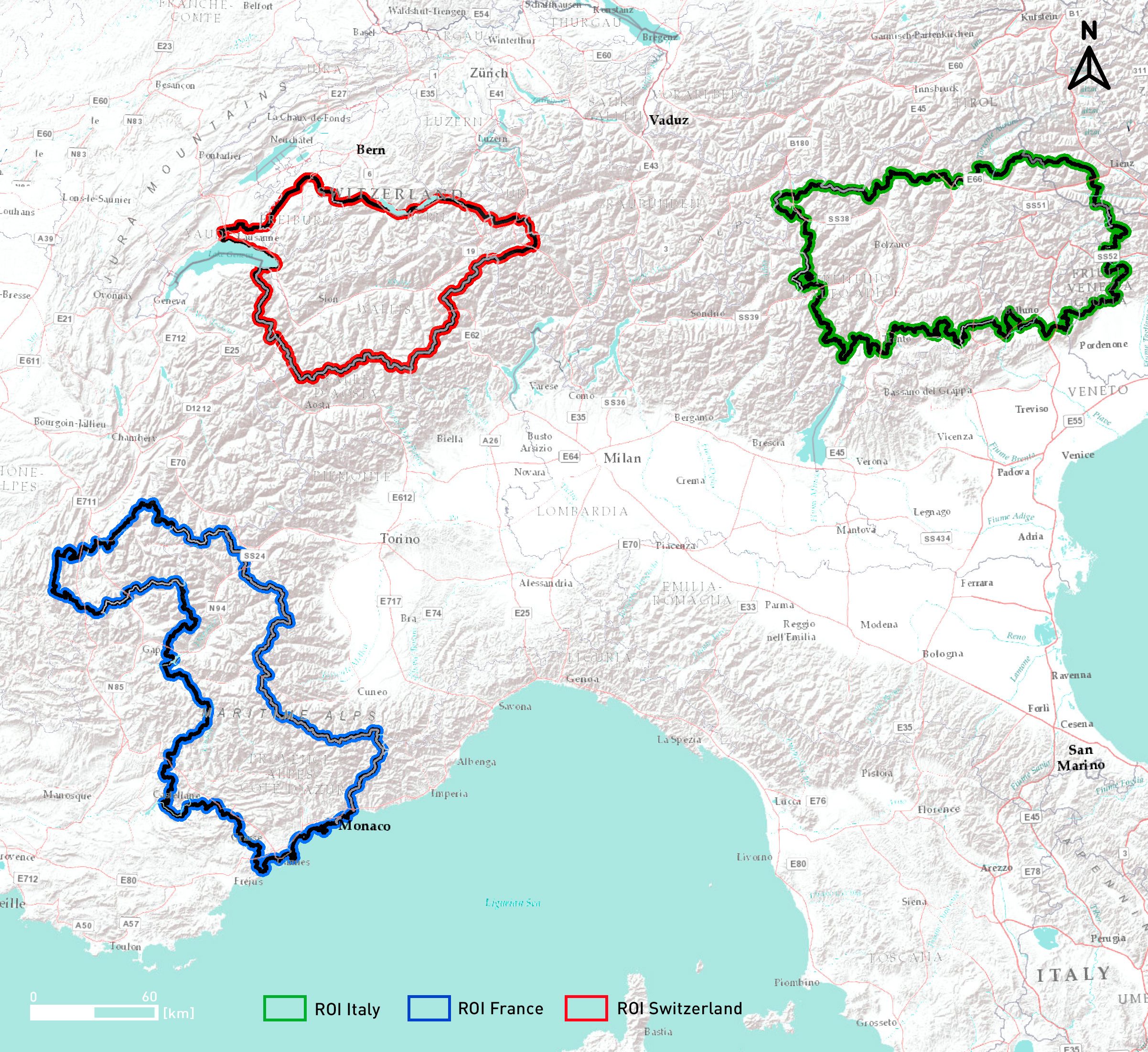
The EO4Alps Landslides project is an initiative funded by the European Space Agency (ESA) focused on improving landslide risk management in the Alpine region using satellite Earth Observation (EO) data. The project focused on pilot areas in the French, Swiss, and Italian Alps.

TRE ALTAMIRA (TREA) is part of the consortium that conducted the project, which included experts in landslide science, geological risks, InSAR processing and IT, and geological surveys.

EO4Alps-image-2
Areas Of Interest selected for the founding project. ©TRE ALTAMIRA 2022, background: ESRI Topographic.

The challenge

Landslides pose a significant threat to local communities, infrastructure, and the environment. Monitoring such hazards is crucial for risk assessment and effective mitigation strategies.

InSAR analysis

TRE ALTAMIRA performed an InSAR analysis of ground deformation over the three areas outlined in the image above. Sentinel-1 images acquired between 2014 and 2023 were processed with TREA’s SqueeSAR® algorithm. The ascending and descending LOS results were combined to produce 2-D (Vertical and East-West) measurements.

InSAR benefits

Thanks to its satellite-based nature and comprehensive swath coverage, InSAR technology is able to measure subtle ground movement over large and remote regions, identifying areas at risk without the need for any in-situ equipment.

Switzerland-vert

Switzerland-east

Italy-vert

Italy-east

Examples of SqueeSAR® results over Switzerland (top) and Italy (bottom). Left images show Vertical displacement and right images East-West displacement. Contains modified Copernicus Sentinel data 2014-2022.

Each Measurement Point (MP) comprises the values of ground displacement over time (time series), average displacement rate, and acceleration over the full period.

switzerland_TS
Time series of a Measurement Point subject to significant ground displacement.

By analyzing historical ground movement trends, TREA’s SqueeSAR® results have successfully identified and mapped numerous areas susceptible to landslides.

InSAR proved to be a valuable early warning tool for identifying prone-to-landslide areas and monitoring their evolution over time, thereby enhancing risk assessment and supporting the implementation of mitigation strategies.

For more information, visit https://www.eo4alps-landslides.eu/ or https://eo4society.esa.int/projects/eo4alps-landalps/ EO4Alps supports sustainable land use planning with innovative EO-based landslide mapping and monitoring.