

Wide Area Monitoring| Groundwater Management | Historical Analysis
TRE ALTAMIRA Inc (TREA) provides the California Department of Water Resources (DWR) with InSAR ground displacement monitoring data for over 500 groundwater basins, in support of the state’s Sustainable Groundwater Management Act (SGMA) of 2014.
This project not only allowed TREA’s team to develop the first-ever statewide subsidence monitoring system, but also highlighted previously undetected areas of displacement. Some agricultural areas in the Central Valley showed more than 3 feet (90 cm) of deformation over three years.
The project area covers 101,210 km2 (39,000 mi2), TREA delivers both the vertical displacement InSAR data and statewide 100m grid raster maps (with monthly time stamps). These provide a holistic view of ground displacement that the DWR never had previously.
InSAR analysis
The baseline / historical analysis covered the period 2015 to 2018, using 6,424 Sentinel-1 images. The 1-D Line-of-Sight results were combined to produce vertical measurements. The statewide dataset was updated annually in October 2019 and October 2020, shifting to quarterly updates in April 2021.
SqueeSAR® results
The SqueeSAR® (TREA’s advanced algorithm for surface displacement detection) results were calibrated and validated using ground-based GPS stations. The results identified more than 185 million measurement points, revealing large areas subject to subsidence due to groundwater extraction.
InSAR benefits
InSAR’s ability to detect subtle ground movements over large regions or countries helps to identify potential natural hazards like landslides and subsidence, enabling enhanced risk assessment, intervention planning, and resource management.
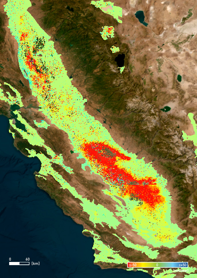
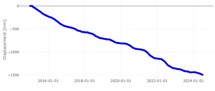
Using a combination of advanced algorithms, rigorous quality control procedures, cloud computing, and publicly available ESA Sentinel-1 satellite data, TREA provided DWR with precise updates on ground displacement at a state scale for the sustainable management of California’s water resources.
To know more, read the latest TREA's public report.