TRE Altamira is at Tailings and Mine Waste 2022 to present InSAR for Mining

Ground instabilities pose many challenges to mining sites. Whether they affect slopes, tailings storage facilities, or waste piles, the early identification and ongoing monitoring of unstable areas is key to ensure the continuity and safety of operations, as well as timely inspections and maintenance. In fact, strategic, frequent monitoring of ground stability is essential to assure the timely detection of precursors to failures.

Thanks to their sensitivity to subtle displacement, wide-area coverage, and remote-sensing capabilities, TRE Altamira’s InSAR ongoing monitoring services are helping engineers and asset owners in the mining industry in the early identification of ground risk.

Waste Pile
Waste pile monitoring with InSAR. The measurement points show ground instability, identifying the red area as the most affected by ground displacement. The time series of displacement describes the movement between January and November.
Tailings Dam
Tailings dam monitoring with InSAR. Deformation patterns are identified by InSAR analysis, corresponiding to the red area.

By accessing satellite imagery archives back to 1992, experts are able to enhance geotechnical back analysis by identifying patterns of unstable behaviour to better understand the cause of the displacement.

Satellite InSAR technology provides a clear understanding of the ground behavior when used in conjunction with complementary conventional ground-based surveying instrumentation.


What are the benefits of InSAR?

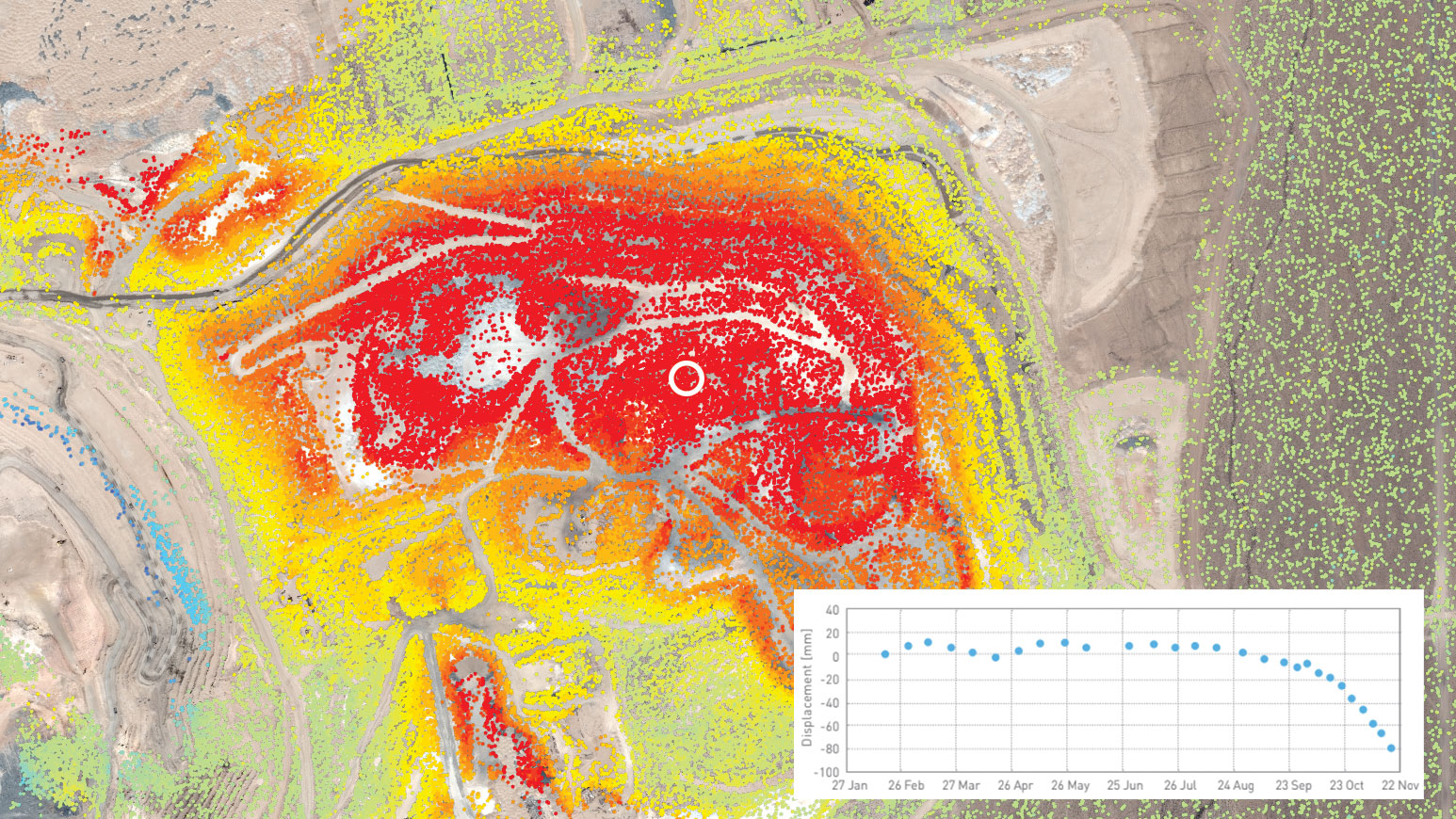
Spatially dense results with millimetric precision

spatially dense and precise resultsInSAR provides ground displacement measurements with millimetric precision, sensitive to movement as slow as 1 mm/year.

Non-invasive and scalable technique

non-invasive scalabilityInSAR is a remote sensing technology and provides accurate displacement measurements over individual assets as well as entire countries/continents.

Weekly ground displacement updates

Weekly updatesThanks to a new generation of satellites, it is possible to receive weekly updates on ground displacement.

Risk assessment

Risk assessmentThe timeliness and accuracy of results aids geotechnical engineers in risk assessment and supports decision-making processes.

Our experienced and multilingual team of InSAR experts are available to answer your questions.
Feel free to contact us anytime to ask for a consultation.

Marie Josee Banwell
Business Development
North America

Tel: +1 604 315 6525

Contact

Francesco Meloni
Business Development
Africa, Europe, Central Asia

Tel: +39 3420876992

Contact

Jessica Morgan
Technical Sales Representative & Country Manager
Australia and New Zealand

Tel: +61 455 154 552

Contact


Our brochure


Mining Assets


To learn more about InSAR for the Mining industry, visit our Mining page.

Thank you for visiting us at Tailings and Mine Waste 2022